


The Costa Blanca has some of the best walking routes in Spain. This is Alicante Province, a breathtaking land where coastal paths follow cliff-backed coves and sand dunes, and woodland mountain trails reach summits with the most extraordinary views of the Mediterranean Sea.
Here’s our guide to the best walks on the Costa Blanca, coastal trails and hikes in Alicante mountains.
- Costa Blanca Mountains
- 1. Mount Montgó Summit Trails
- 2. Benissa Coastal Walk
- 3. Peñon de Ifach – Calpe Rock Summit
- 4. Sierra Bernia Ridge Loop Trail
- 5. Guadalest to Altea Night Walk
- 6. Sierra Helada Benidorm Ridge Trail
- 7. Puig Campana Summit and Loop Trails
- 8. Sierra Aitana Loop Trail
- 9. El Hondo Wetlands Lagoon Walk
- 10. Southern Costa Blanca Coastal Walks
- 11. Costa Blanca Inland Walking Route
- Advice For Walking In Alicante Mountains
- Related Posts: Popular Hikes in Spain
- Related Posts: Hikes Around The World
11 Best Costa Blanca Mountain Walks and Coastal Trails
Costa Blanca Mountains
Several well marked walking routes will take you to the top of Costa Blanca’s most famous mountains – Alicante Province has over fifty 1,000+ metre peaks which make up part of the Betic System, one of the major mountain ranges in Spain.
The best known summits and ridges include Sierra Aitana (1,550 m) where you feel you’re on top of the world, Puig Campana (at 1,436 m above sea level, this hike is worth the effort -try it by moonlight in the summer and wake up to see the dawn paint Benidorm bay crimson red- or the Sierra Helada natural park and marine reserve where you can spot dolphins swimming near the shore, Mount Montgó in Dénia which has views to the island of Ibiza on a clear day, Sierra Bernia and the ancient fort, Ifach Rock in Calpe which is also a climber’s delight (rises 332 m from the sea), and so many more interesting places to walk, cycle and even paraglide!
1. Mount Montgó Summit Trails
There are several trails across the Montgó Nature Park which separates the coastal towns of Dénia and Jávea, with differing degrees of difficulty and length. The most popular hike zigzags up a rocky path on the eastern face of the Montgó massif to the plateau at the summit 753 m above sea level.
To get there, drive out along the CV-736 road from Dénia to Jávea, and park your car at the shooting range where the walk commences at the well-marked trailhead. The trek from here is uphill across the Montgó plains on forestry tracks, and is fairly easy except for the steep scramble up the last bit before the trail opens onto a grassy plateau. The panoramic view of the coastline is stunning.
Alternatively hike the tougher PR CV355 route which leads up to Montgó conservation area from Jávea harbour, to Cape San Antonio lighthouse, past picnic areas and windmills, down to Tallada Cove, and eventually takes the same path up to the summit.
The protected parkland has a choice of walking routes with differing degrees of difficulty and length. A flat walk along the road to the lighthouse at Cape San Antonio (you can also drive here) takes you past tree-clad picnic areas along the way. An interesting trail leads to Jávea windmills sitting on the cliff edge, then steeply down to the town itself (approx. 10 km, 3 hours one-way to Les Rotes promenade).
* Dénia shooting range to Montgó summit
Distance: 4 km one way – Time: 2 hours approx;
* PR CV355 route from Jávea Port to Montgó summit
Distance: 16 km one way – Time: 7 hours approx.
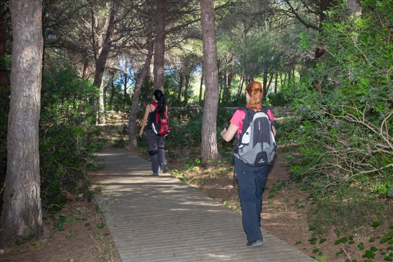
2. Benissa Coastal Walk
If you’re looking for things to do on the Costa Blanca, Benissa has a beautiful cliff walk which reaches along the Mediterranean shoreline towards Calpe. The footpath starts by La Fustera Beach and follows the coast southwards to Les Bassetes harbour.
The Eco Walk is well maintained and sign posted, with information panels explaining points of interest as well as images of the local wildlife and plants. There are picnic areas where you can relax on a bench under the trees, and steps down to the beaches below – you’ll find summer ‘chiringuito’ beach eateries by some of these coves and there are various restaurants along the way (openings may be seasonal).
* Benissa Ecological Path
Distance: 3.5 km one way – Time: 1 hour at an easy pace
3. Peñon de Ifach – Calpe Rock Summit
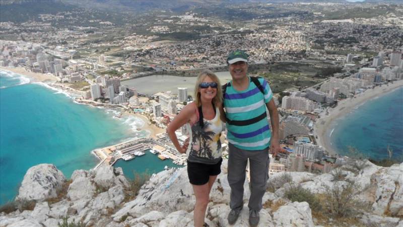
Colloquially know as ‘Calpe Rock’, Peñon de Ifach juts into the sea by the fishing harbour. A protected nature reserve with an information centre at the entrance, entry may be limited on a busy day. The first part of the trail is fairly easy and flat, the path leads through a rock tunnel and along the lower part of the mastiff. However, the hike up to the top is strenuous although not difficult.
Trekking shoes with a good tread are a must as the path can be slippery and you need to watch your footing. The vision from the plateau at the top is worth the sweat, Calpe salt lake and beaches looking quite spectacular hundreds of feet below. Don’t be surprised if you hear voices, these are climbers intrepidly scaling the rock wall on the sea side.
* Peñon de Ifach trail to the summit and back:
Total distance 4.6 km, takes around 2 hours 30 min.
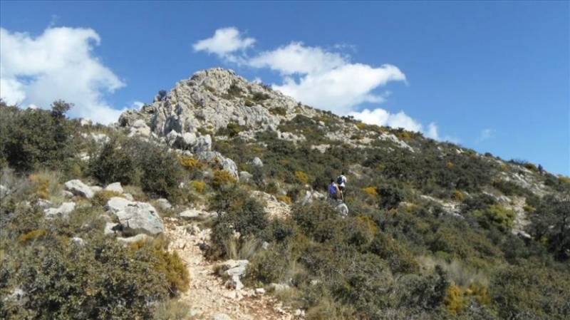
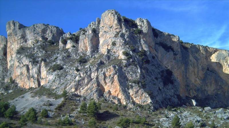
4. Sierra Bernia Ridge Loop Trail
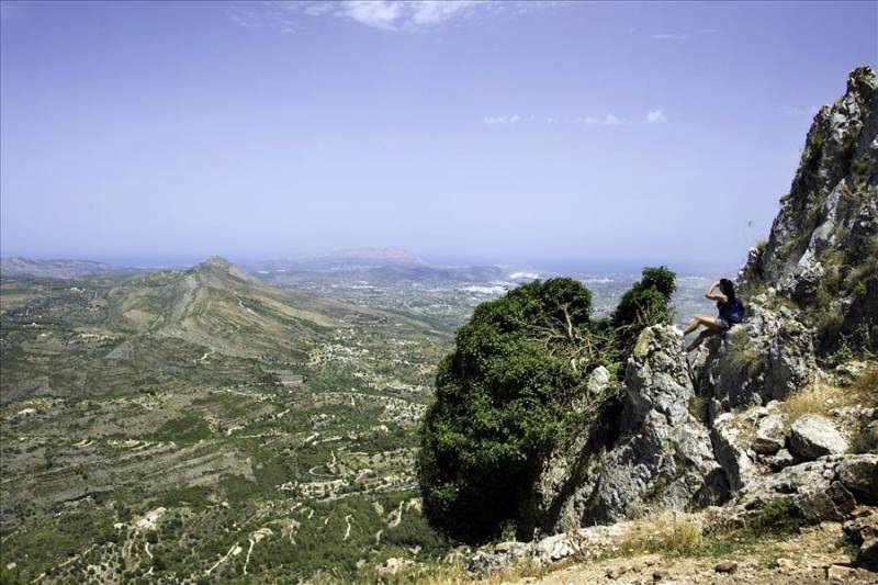
Sierra Bernia ridge divides the Marina Alta from the Marina Baja (the highlands and the lowlands of Costa Blanca) and is one of the best walks in Alicante. From Benissa drive inland towards Jalón, take a lefthand turning to Pinos, further on there’s parking space beside ‘Casas de Bernia’, the outbuildings at the start of the round route.
The easy-to-do path to the right takes you up and over to Bernia Fort, ancient ruins with the most spectacular views to Benidorm and beyond – this is the busiest part of the trail as many just walk to the fort and back.
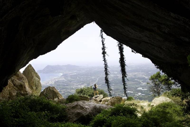
For the loop, take the left-hand trail which is more difficult to navigate and more suitable for experienced trekkers or those with a professional guide (or friends who know the way). Avoid the strips of shale and don’t get lost! A scramble up smooth rock leads to the low-roofed Forat tunnel, where you basically sit on your butt and slide out the other side to the same awesome views!
Follow the straightforward stony trail to the ruins of Bernia fort, take a few selfies, rest and admire the vistas, then traipse further on around back to the car. Overall, this scenic trek takes a few hours if you relax the pace so bring something to eat and drink.
* Sierra Bernia loop from ‘Casas de Bernia’:
Distance 10 km, takes approx. 4 hours.
5. Guadalest to Altea Night Walk
The Guadalest to Altea summer night walk is the most epic trek on the Costa Blanca, the yearly event takes place to coincide with the full moon late July/early August and is arranged by the regional Spanish Nordic Walking Federation together with Marco Polo Expediciones, a local adventure company. Children over 12 are welcome if they enjoy cross-country walking and are accompanied by an adult (check details with the organizers).
Register online to participate: a nominal cost covers insurance, the coach ride up to the starting points (the first one begins higher up the trail by Guadalest dam), experienced guides, participant’s t-shirt, refreshments (fruit and water) halfway along the route, and a mega supper at the finishing point – pizza, Spanish omelette and beer come to mind!
Altea night walk is all downhill and not difficult, mainly on tracks and stretches of stony dry river bed. You will need a headlamp, sturdy comfortable hiking boots and suitable long trousers. ‘Rescue vehicles’ are ready on nearby roads to pick up tired souls who want a lift back or in case of necessity. Everything is super organised in conjunction with the local authorities, with a focus on safety as well as outdoor fun.
* 20 kilometre Altea night walk starting at Guadalest dam takes 5 hrs approx. (the shorter walk is 15 kms). Inscription form on https://www.nordicwalkingcv.com/es/
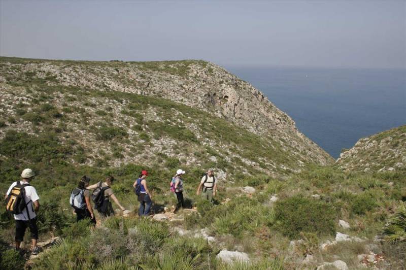
6. Sierra Helada Benidorm Ridge Trail
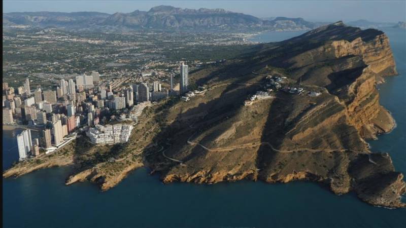
Sierra Helada is a high ridge running perpendicular to the coast, separating Altea seawards from Benidorm. Protected parkland with extraordinary views from the crest above the two bays – eastwards towards the Peñon de Ifach, south over the Mediterranean Sea, west to the iconic skyscrapers of Spain’s number one ‘holiday town’, north to Puig Campana peak and the Guadalest Valley. This hike is more exhausting that it looks.
At the start of El Albir lighthouse walk, a well signposted track leads steeply up to the ‘TV antennas’, the highest point at 438 m. From here there’s an access road (authorized maintenance vehicles only) which ultimately leads down to a residential area of El Albir in the foothills. However, you can continue trekking along the top of the ridge, scrambling up and down a series of deep gullies along the way.
The panorama is astounding as you reach ‘the cross’ landmark with Benidorm spread-eagled at your feet. Stay around to film the sun setting over the waters and the million lights illuminating the cityscape. Alternatively, just do the Benidorm to the ‘cross’ section, an exhilarating hike along an unfrequented cliff road (or cheat and drive up!).
* Sierra Helada trail – El Albir to Benidorm
Distance 7 km one-way, 4 h 30 minutes approximately from El Albir (Sierra Helada visitor’s centre by the lighthouse path) to Benidorm Cross.
A further 3 kilometres, 50 minute walk from the cross down to Benidorm Levante beach.
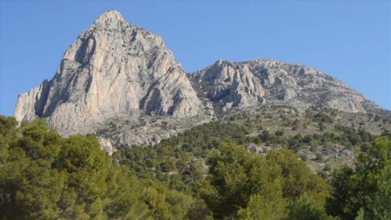
7. Puig Campana Summit and Loop Trails
The famous mountain behind Benidorm is called Puig Campana (1,436 m) and it’s the second highest peak in Alicante Province. There are loads of country walks in this area of the Costa Blanca but these are the main two.
Puig Campana loop is fairly simple but time it carefully to finish well before dark (like all mountain walks it can be treacherous if you lose your way). Always go prepared with adequate clothing for the weather conditions and good hiking boots, energy snacks and water, take a well charged phone and tell someone where you are going.
Head for Finestrat village and take the road up to the start of the trail near the Font de Moli spring. The left hand path gradually takes you up and around the base of the mountain. You’ll come to a point where there’s a clearing and a turnoff, the trail that leads to the summit. It’s a good place to stop for a rest and quick snack from your backpack!
Continue on the circular route which is really quite easy until you come around to the other side. Stop to marvel the views to Altea Bay and Benidorm then continue around towards Finestrat. The trail fades a bit across the flattish rock face which is split by a ravine, not a great problem to circumvent in the daylight. The last part of the walk is through pinewoods and past some outlying villas.
The strenuous summit trail to the top of Puig Campana starts from the turnoff point mentioned above, you can’t really get lost but mind your footing at every step. There are a couple of areas of flat terrain part way up where you can rest and catch your breath. The summit has the best views in the whole Costa Blanca!
To do the Puig Campana summit, you’ll need to be fit and proper footwear is essential, it’s a steep sharp ascent and there are patches of shale. Check the weather forecast carefully as this path is dangerously slippery in wet weather. Camping up here over night is cool although not comfortable, to see the sun rise over the Mediterranean is just awesome.
* Puig Campana loop (PR-CV 289) and summit
Distance 11 km, 5 hours at an easy pace; Loop and summit 18 km.
8. Sierra Aitana Loop Trail
At 1,550 m above sea level, Sierra Aitana is the highest mountain in Alicante Province and not surprisingly has a legendary walk. From the Benidorm area, drive up and past Guadalest to Benifato village, then take a signposted righthand turn up a steep potholed road to Font de Partagas. A scenic recreational area with a pure mountain spring passing through the meadow, BBQ facilities and stone tables, it’s a nice place to picnic with the family. The foothills are great for wild camping too.
The circular trek leads up the northern slopes of Sierra Aitana to ‘Fat Man’s Agony’ a narrow gap high up in the rock face perilously near to the precipice. Squeeze through to the other side where the landscape is fairly barren and flat but with deep crevices in the rocky ground. The incredulous panoramic views for miles around reach to the sea and remote countryside where grazing goatherds are the only sign of life. The landmark Aitana ‘radar domes’ are also clearly visible. The trail zigzags down for an easy walk back to the starting point.
* Sierra Aitana loop
Distance 12 km, takes approximately four hours from Font de Partagas.
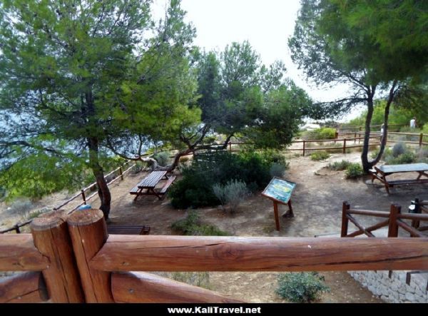
9. El Hondo Wetlands Lagoon Walk
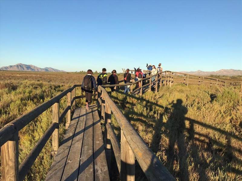
Also known as ‘El Fondo’, this is a country walk through the wetlands of Elche’s nature reserve, a wild bird conservation park where wood plank walkways skirt the lagoons. There is a large car park by the information centre, where you should register your visit before entering the conservation area.
Some of the species you’re likely to see include the marbled teal ducks, white-headed ducks and roseus greater flamingos. Wear sunscreen in summer and lash on the mosquito repellent any time of year or wear long sleeves and trousers.
Contact El Hondo Visitor’s Centre in advance if you want to book a guided tour
Call 966 67 85 15 / 679 195 852 or email parque_elhondo@gva.es
10. Southern Costa Blanca Coastal Walks
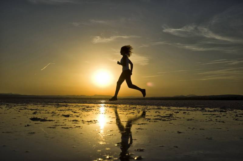
Enjoy walking along the magnificent beaches and dunes of Costa Blanca’s southern resorts, from the Santa Pola – Elche coastline down to Guardamar del Segura and Torrevieja. A succession of nicely paved paths and promenades skirt the Orihuela and Pilar de La Horadada coast, making the perfect setting for a gentle stroll, jogging or cycling.
11. Costa Blanca Inland Walking Route
The GR-330, Costa Blanca Inland Path covers 434 kilometres of Mediterranean landscape from the trendy leisure harbour at Dénia to the ancient city of Orihuela, taking in everything from the highest peaks of the region to some of the best nature parks, across pine-clad hills where aromatic herbs grow wild to arable land with centuries old almond and olive trees, past the orange and lemon groves to fields of vines, following the valleys and rivers of inland Alicante, visiting rural villages and exploring their castles, and finally trailing back to the sand dunes of the sunny southern coastline before cutting back to the medieval city.
Sounds daunting? Not really, you can walk the Costa Blanca inland walking route in 20 daily episodes split over time and not all at once with the help of a handy GR-330 guide map, downloadable for free from the official Costa Blanca tourism site: Costa Blanca Inland Walking Guide
Advice For Walking In Alicante Mountains
Alicante is worth visiting all year round particulary if you like a warm climate. However, regarding mountain walking you should plan your visit according to the season and always check the weather forcast before setting out.
In summer, avoid trekking in the mountains during the heat of the day – it’s best to go out early morning when it’s cooler or wait to the evenings when the sun goes down. Coastal walks are pleasant in summertime and you can stop for a swim in the sea when it’s too hot (remember your sunscreen and hat)!
A night walk is another option for more experienced trekkers but doublecheck the weather to avoid any storms, wear the right gear and a headlamp – don’t forget warm clothes and refreshments if you’re hiking a high peak and want to wild camp overnight.
Spring and Autumn are the ideal months for trekking in Alicante mountains as it’s generally sunny and warm at this time of year. Once again, check the local weather before setting off to rule out any storms or possible flash floods – although it doesn’t rain often in the Costa blanca, the occasional, localised and extremely heavy downpours are a hazard.
The winter is also a great season for hiking on the Costa Blanca but do wear layers of clothing (temperatures can vary vastly between a sunlit slope, the shady side of a mountain or the wind-chilled summit). Verify the time of sunset, make sure you finish the hike before dark and beware of mist.
Although it’s not obligatory in Spain, insurance that includes mountain pursuits is advisable to cover any eventualities when walking in the mountains (such as twisting an ankle and having to be carried off!).
Official trails are usually well-marked, however if you’re not an experienced hiker, prone to getting lost, or just prefer to walk with a group of like-minded people, contact an authorised guide or local adventure company.
As always, wear adecuate clothes and hiking boots for mountain walking, take a lightweight backpack, water to drink and energy snacks, and importantly a fully charged phone with a good camera and internet connection (can be used as a flashlight if necessary) – remember to take a photo of the route map beforehand.
Looking for more activities on the Costa Blanca? Then check out our popular guides to:
Tandem Paragliding on Costa Blanca
Best Snorkeling and Scuba Diving in Costa Blanca
Related Posts: Popular Hikes in Spain
Sierra Nevada Mountains (Granada)
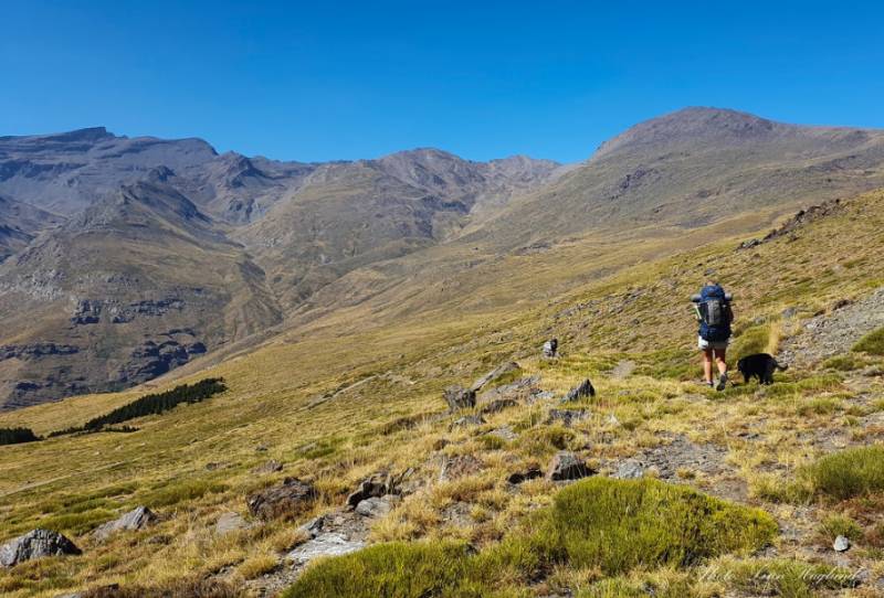
There are lots of exciting things to do in Sierra Nevada mountain range. See the whitewashed villages, walk the high trails or ski across the mountains of Granada…
Related Posts: Hikes Around The World
Poon Hill – 6 day Annapurna Trek, Nepal
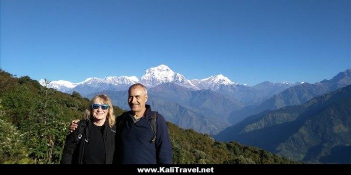
Annapurna Conservation Area in Nepal.
Our 6 day Poon Hill trek in the Himalayan foothills is an adventure which starts in Hile, a hamlet on one of the ‘easiest’ routes in the Himalayas…
Peru – Adventure from Cuzco to Machu Picchu
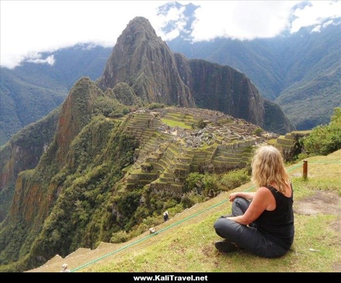
Seven days of pure adventure in the Andes from Cuzco through the Sacred Valley to Machu Picchu – it’s a ‘new 7 Wonders of the World’. Peru’s most treasured site and one of the most spectacular places on the planet, this is a must-see on our around-the-world trip!
Discover the World with ![]() the blog with a focus on independent travel.
the blog with a focus on independent travel.
Wow, great views! Calpe Rock looks amazing.
The Peñon de Ifach is not a difficult walk as long as you don’t suffer vertigo! The views are amazing, over 2 bays and the lagoon!
Wow you aren’t wrong, there is some great hiking here. I’d even do the one over Benidorm. When I come to visit I’ll bring my hiking
Boots. #TravelBlogTuesday.
‘Benidorm Mountain’ the Puig Campana is the epic hike and the most difficult, the steep ascent and sharp change in altitude as you start near sea level. I’ve only done it once! Would love to go up again and stay overnight to see the dawn but not sure I’m brave enough.
Wow so many amazing hikes. I’d enjoy them all but especially that view from Calpe Rock summit. That would be worth climbing for :)